History of the Route 65 Corridor Study
In 2018 the Remaking Cities Institute at Carnegie Mellon University and Quaker Valley Council of Governments received support from Mobility 21 and the Pennsylvania Department of Community and Economic Development to examine the impact of the Route 65 highway corridor on the 19 communities that line it from the City of Pittsburgh line to Rochester, PA. Considering social, economic, and technological factors, the study will assist communities form strategies and plans to improve the quality of life along the corridor. This first phase was completed in October of 2019.
In November 0f 2020, the project resumed with the addition of Michael Baker, International to the team. This phase of the project will focus on case studies and workshops focused on municipalities that are emblematic of the experiences of all 19 communities along the Rt 65, and indeed, for small towns along major highway corridors thought the Commonwealth of PA.
On January 26, 2022, members of Traffic 21 (Carnegie Mellon University) & Michael Baker International presented the final report for the Route 65 Study. The presentation included a comprehensive summary of the report as well as a list of recommendations moving forward.
Route 65 Corridor Study Overview
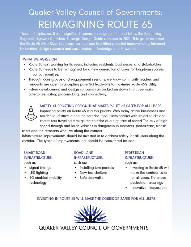
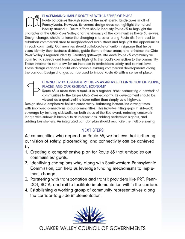
The Strategic Design Guide incorporates focused case study work on the Route 65 Ohio River Boulevard corridor and a broader review and analysis to redefine regional highway corridors. The planning and design of corridors, on Route 65 and statewide, reflect a need for both standardization and stronger identity of place. The Route 65 Ohio River Boulevard corridor, focusing on the historic “Boulevard” portion of the roadway and its surroundings from Bellevue to Rochester, provides an ideal case study location, specifically looking at the Boroughs of Emsworth and Ambridge through collaborative public design workshops.
The Guide provides preliminary recommendations to improve the Route 65 corridor for several key objectives, developed through analysis of existing conditions, community-engaged workshops, and technical and best practices review. The study’s key objectives include creating synergistic and locally based relationships between the communities and boroughs that the route serves; recognizing and responding to commonly held corridor-wide citizen concerns; creating a unifying, place-based aesthetic, and providing a strategic guide for reimagining the highway corridor as a shared community asset.
The Corridor Design Toolbox identifies potential improvements applicable to Emsworth, Ambridge, and many similar municipalities along the busy corridor, from narrowing travel lanes to creating pocketed turns, enhanced gateways, and designation of pedestrian space, coordinated to support economic growth. Adding to these roadway design guidelines, the study developed strategies for inter-municipal governance, civic engagement, master plan initiatives, and recommendations for local TIP projects.
Next Steps identified in this report will be able to lead to a powerful cumulative impact: from inter-municipal cooperation agreements to the master planning process, to TIP project recommendations. These will all contribute towards the clearly expressed community objective of a safer, greener, cleaner Ohio River Boulevard corridor, one with implications for the regional and statewide approach to highway corridors.
For more information on the Route 65 Corridor Study, please click here
A brief history of the Ohio River Boulevard (Route 65) can be found here.